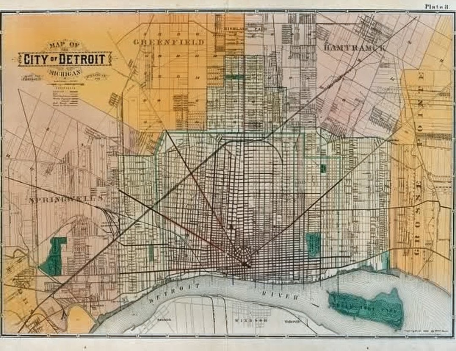
Detroit is not background scenery. Streets, precincts, factories, neighborhoods, bridges, taverns, river crossings, and police buildings shaped how people moved through the city—and how crimes were committed, investigated, reported, and remembered.
The Map Room is where those places begin connecting to one another.
The Map Room uses a stylized case-board as navigation while the factual layer comes from verified historical maps, street grids, addresses, and photographs.
Neighborhood development, major streets, precinct geography, residential blocks, businesses, and the West Side environment surrounding Ralph's earliest police years.
OPEN WEST SIDE →Police headquarters, courts, government buildings, newspaper offices, hotels, commercial corridors, and the institutional center of the city.
OPEN DOWNTOWN →The river as transportation route, international boundary, industrial corridor, smuggling geography, and working waterfront.
OPEN RIVERFRONT →How neighborhoods differed by housing, industry, migration, commerce, ethnicity, transportation, and historical development.
OPEN NEIGHBORHOODS →Where Detroit policing physically happened: precinct houses, headquarters, bureau locations, patrol districts, and the routes between them.
OPEN POLICE MAP →Ford, Lincoln, Vickers, wartime production, factory districts, transportation corridors, and the industrial geography that shaped Ralph's pre-police life.
OPEN INDUSTRIAL MAP →Nightlife geography: commercial strips, taverns, gambling, vice activity, and the spaces where legitimate and illicit Detroit overlapped.
OPEN NIGHT MAP →Selected locations connected to the Ralph Palmer chronology—mapped deeply enough to understand Detroit, but without giving away the investigations.
OPEN CASE GEOGRAPHY →Period street maps, precinct boundaries, transportation routes, industrial areas, neighborhood maps, and overlays built from verified sources.
OPEN MAP ARCHIVE →A responsible then-and-now comparison begins with a verified location. Historical maps, archival photographs, addresses, street alignments and surviving landmarks establish the earlier view; documented present-day photographs show what changed, what disappeared and what remains.
Street history, neighborhood history, architecture, policing geography, transportation, industrial geography, criminology, and Detroit development can be explored in detail. When a location overlaps a Book One or Book Two case, the map may establish the place and historical context while keeping the investigation, discoveries, and outcome sealed.
DETROIT CONTEXT PATH
CONTINUE IN THIS CATEGORY