FILE PATHEXPLORE DETROIT/TRANSPORTATION
DETROIT IN MOTION · PUBLIC TRANSIT

STREETCARS & BUSES.

Public transportation stitched together residential neighborhoods, downtown shopping, employment districts, schools, entertainment, and industrial workplaces. This section examines routes and transfer points as part of Detroit geography rather than treating transit as background scenery.

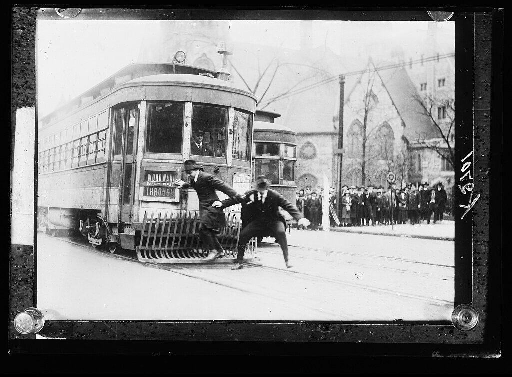
Streetcar safety demonstration, Detroit, Mich.
REAL DETROIT SOURCE · Streetcar safety demonstration in Detroit, photographed between 1915 and 1930.
Source: Detroit Publishing Co. / source record · No known restrictions on publication
RESEARCH LENS

Reading the transit city

  • Streetcar corridors and the neighborhoods they served
  • Bus routes and the transition between transit modes
  • Factory-shift commuting and worker movement
  • Downtown transfer points and commercial streets
  • Period maps, schedules, fares, photographs, and advertisements as primary-source layers
CONNECT THE CITY

Transit stitched the map together.

Routes, schedules, stops, and service changes are used only when period sources identify them.

← DETROIT IN MOTIONMAP ROOMNEIGHBORHOODS

CONTINUE IN THIS CATEGORY