FILE PATHEXPLORE DETROIT/TRANSPORTATION
DETROIT IN MOTION · THE MOTOR CITY

AUTOMOBILES & ROADS.

Detroit did not simply manufacture automobiles; the automobile changed the physical and social scale of the city. This room connects car ownership, roads, parking, traffic, police mobility, commercial corridors, and suburban reach.

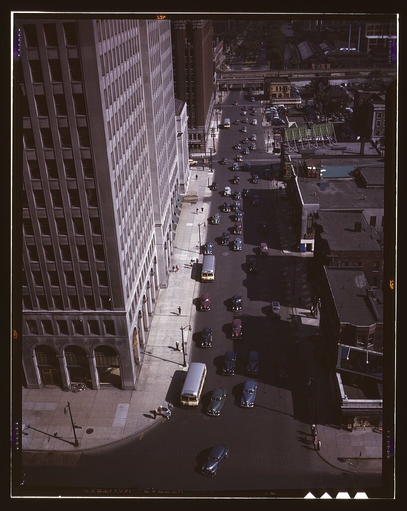
Traffic at 5:30 on Second Avenue, Detroit, Mich.
REAL DETROIT SOURCE · Second Avenue traffic at 5:30 p.m., Detroit, July 1942.
Source: Arthur S. Siegel / source record · Public domain — FSA/OWI
RESEARCH LENS

Reading the automobile city

  • How automobile travel changed distance and accessibility
  • Traffic, parking, garages, service stations, and roadside businesses
  • Police vehicles and investigative mobility
  • Auto theft and automobile-related crime as a separate criminological lens
  • Road maps and period driving routes for comparative overlays
CONNECT THE CITY

Roads connect the other rooms.

Maps, traffic records, photographs, addresses, and period reporting link automobile movement to neighborhoods, policing, crime, and industry without disclosing book investigations.

← DETROIT IN MOTIONMAP ROOMNEIGHBORHOODS

CONTINUE IN THIS CATEGORY